
Security and marking projects for Traffic Electronic Control System corridors (30 routes)
ISSD Bilişim / Antalya / 2024

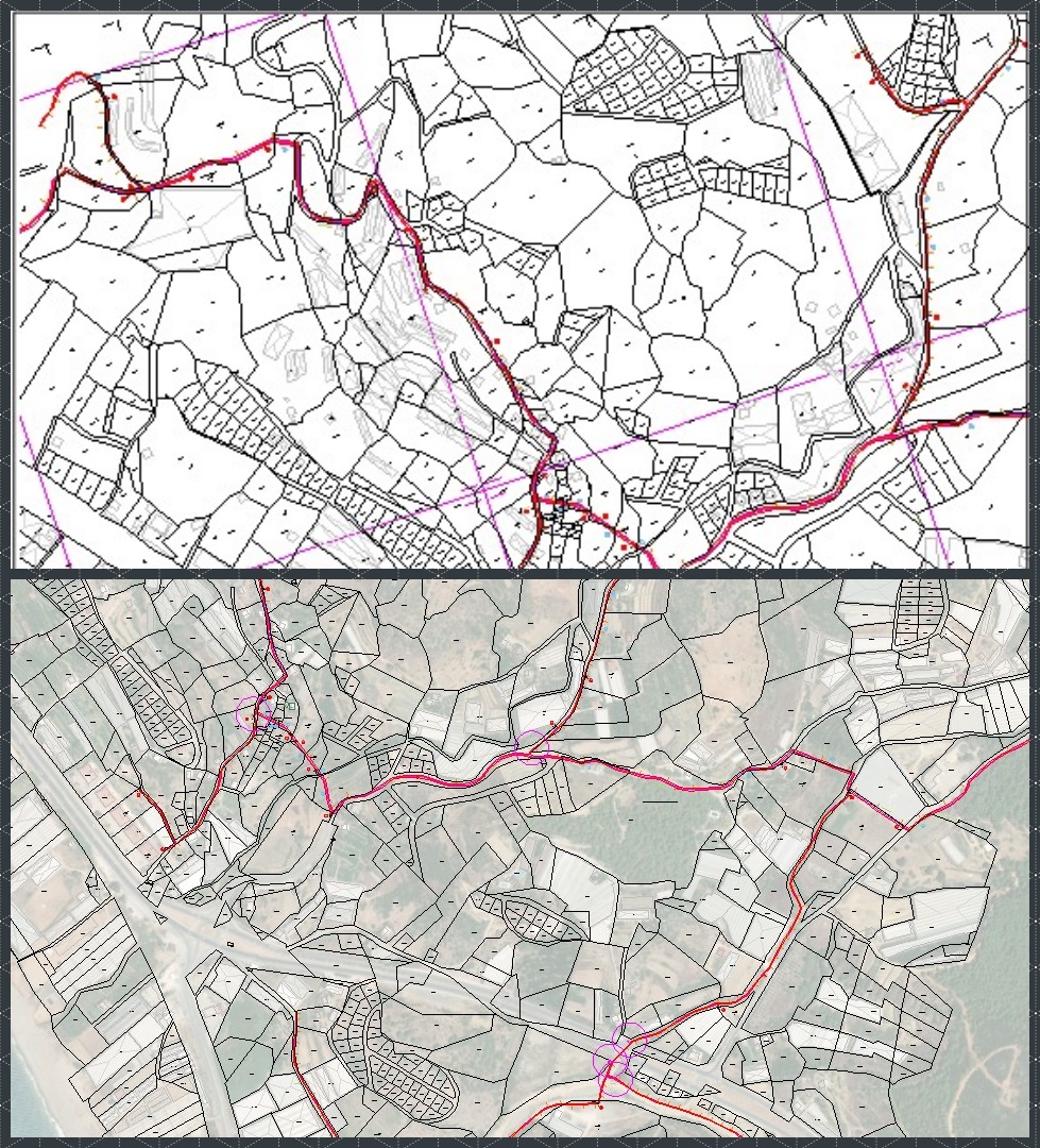
Route maps and feasibility studies for Polatlı-Konya High-Speed Train (YHT) line service roads (163 km)
TCDD / Ankara / 2019
Feasibility study and project design for Masadağı region zoning roads (37 km)
Kepez Municipality / Antalya / 2017
Expropriation plan preparation for Alanya Dim Dam II Irrigation lines (70 km)
DSİ / Antalya / 2024

Feasibility studies and expropriation plans for Taskapi Solar Power Plants GES-1 and GES-2 of Akdeniz Elektrik Dağıtım A.Ş.
Ceylan Co. / Burdur / 2024
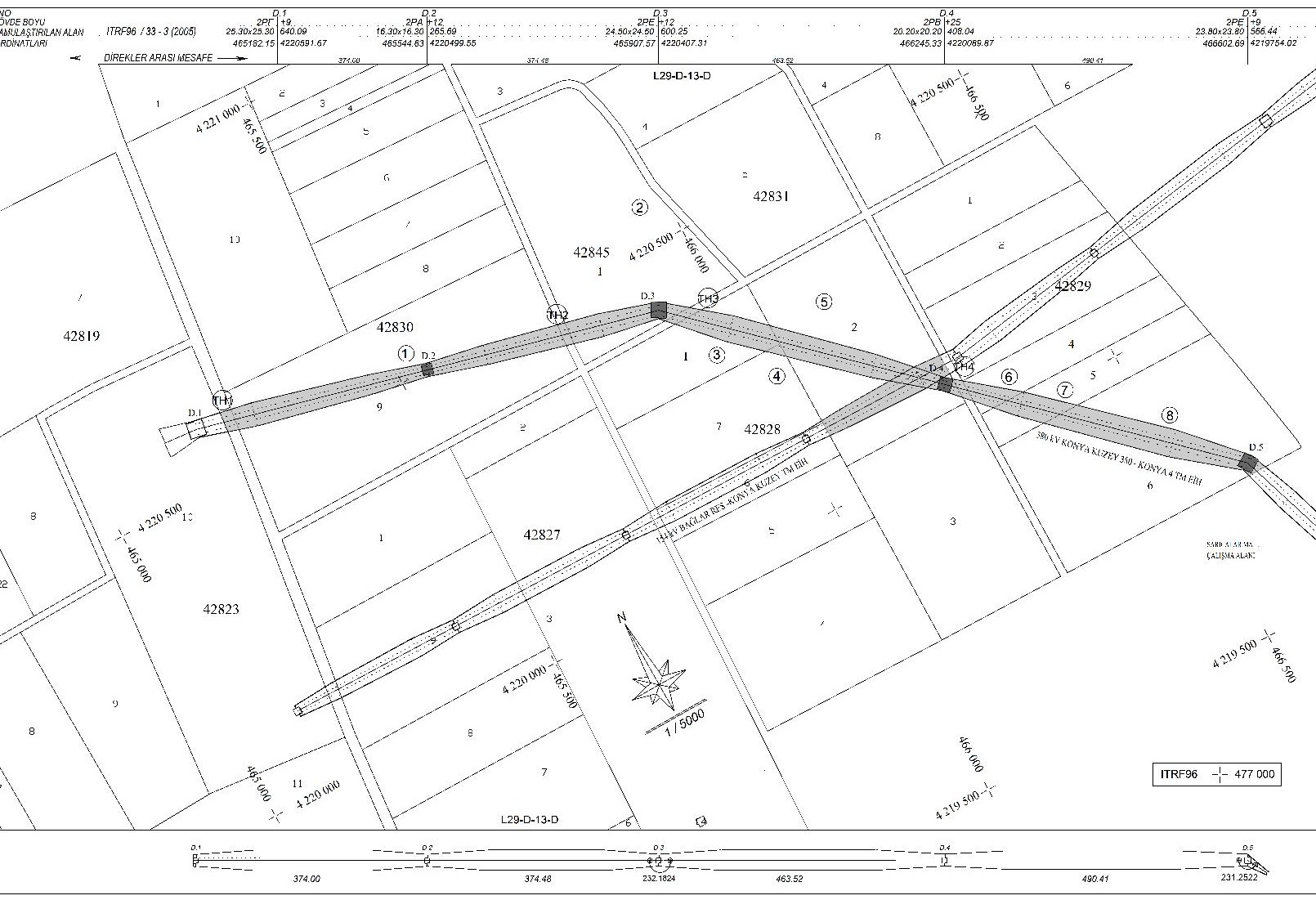
Expropriation maps and zoning plan revisions for the 380 kV Konya North–Konya 4 overhead electric power transmission line.
Turkish Electricity Transmission Corporation (TEİAŞ) / Konya / 2020

Expropriation maps and zoning plan revisions for 154 kV Konya 1 TM- Konya 2 TM- Konya 3 TM renewal and new route, KOS TM connections overhead electric power transmission line.
TEIAS / Konya / 2018

Expropriation plans, zoning plan amendments, and forest allocation plans for the 154 kV Tracim-Demirkoy overhead electric power transmission line.
Turkish Electricity Transmission Corporation TEIAS / Edirne / 2018

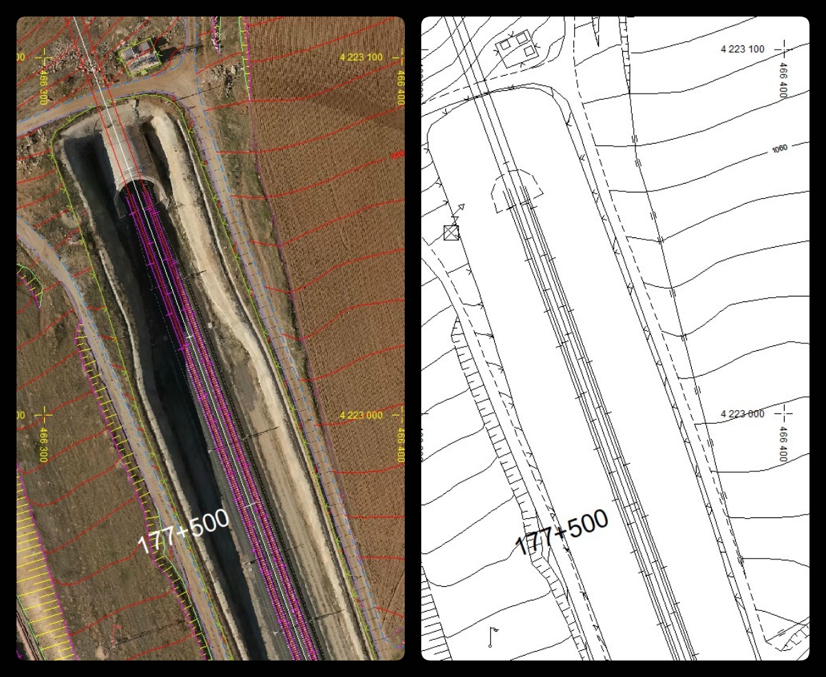
Expropriation plan preparation for Gebze Köseköy section of YHT line (44+436 – 100+150)
General Directorate of Turkish State Railways (TCDD) / Istanbul / 2017
Expropriation plan preparation for Konya-Karaman High-Speed Train Project
General Directorate of Turkish State Railways (TCDD) / Adana / 2016

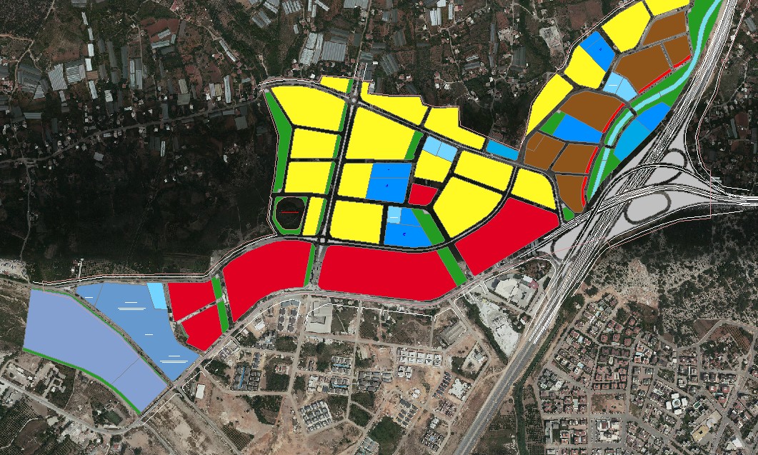
Expropriation plan preparation for the North Bypass Road Korkuteli intersection Varsak section
Antalya Metropolitan Municipality / Antalya / 2016
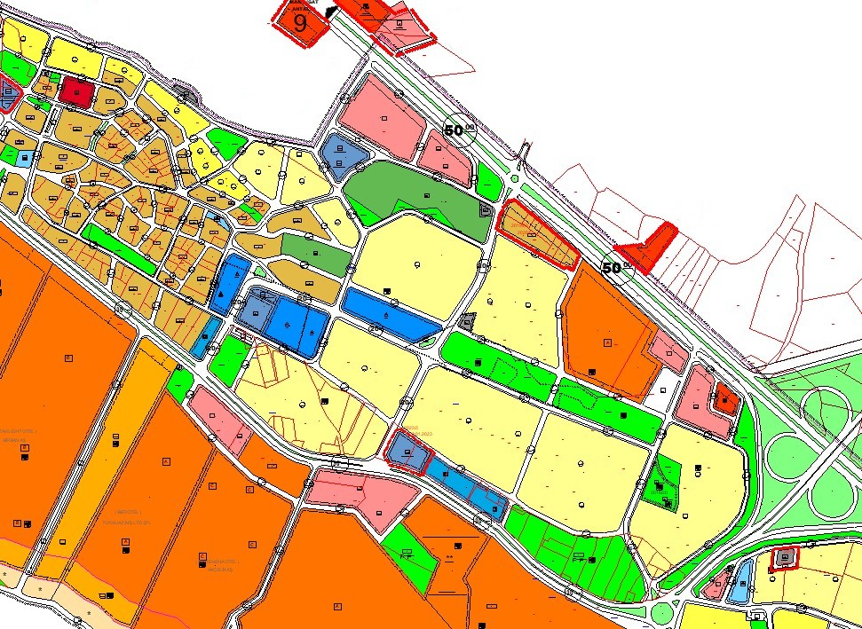
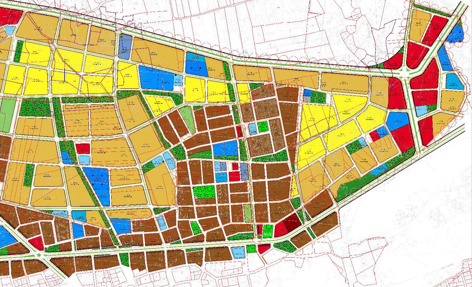
Zoning and parcellation plans for Kızılağaç and Karacalar neighborhoods (68 ha)
Manavgat Municipality / Antalya / 2024
Zoning and parcellation plans for Kepez Duraliler neighborhood
Antalya Metropolitan Municipality / 2024
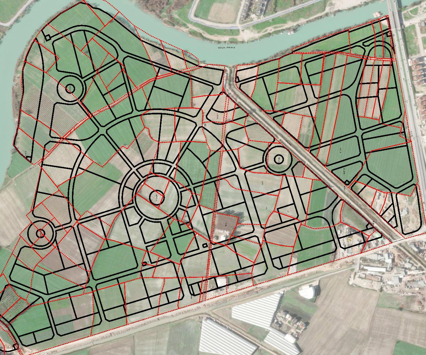
Parcellation plans for Guzelbag and Guzeloba neighborhoods, south of the airport (237 ha)
Muratpasa Municipality / Antalya / 2024
Zoning and parcelization plans for Side Tourism Region Kum area
Manavgat Municipality / Antalya / 2020
Parcellation plans for Kargicak Alanya Tourism area.
Regional Directorate of Foundations / Antalya / 2013

Identification and registration of 22 Village Settlement and Development areas in Elmali and Finike districts.
Special Provincial Administration / Antalya / 2012
Digital photogrammetric current map production for Burdur province
Burdur Municipality / Burdur / 2024
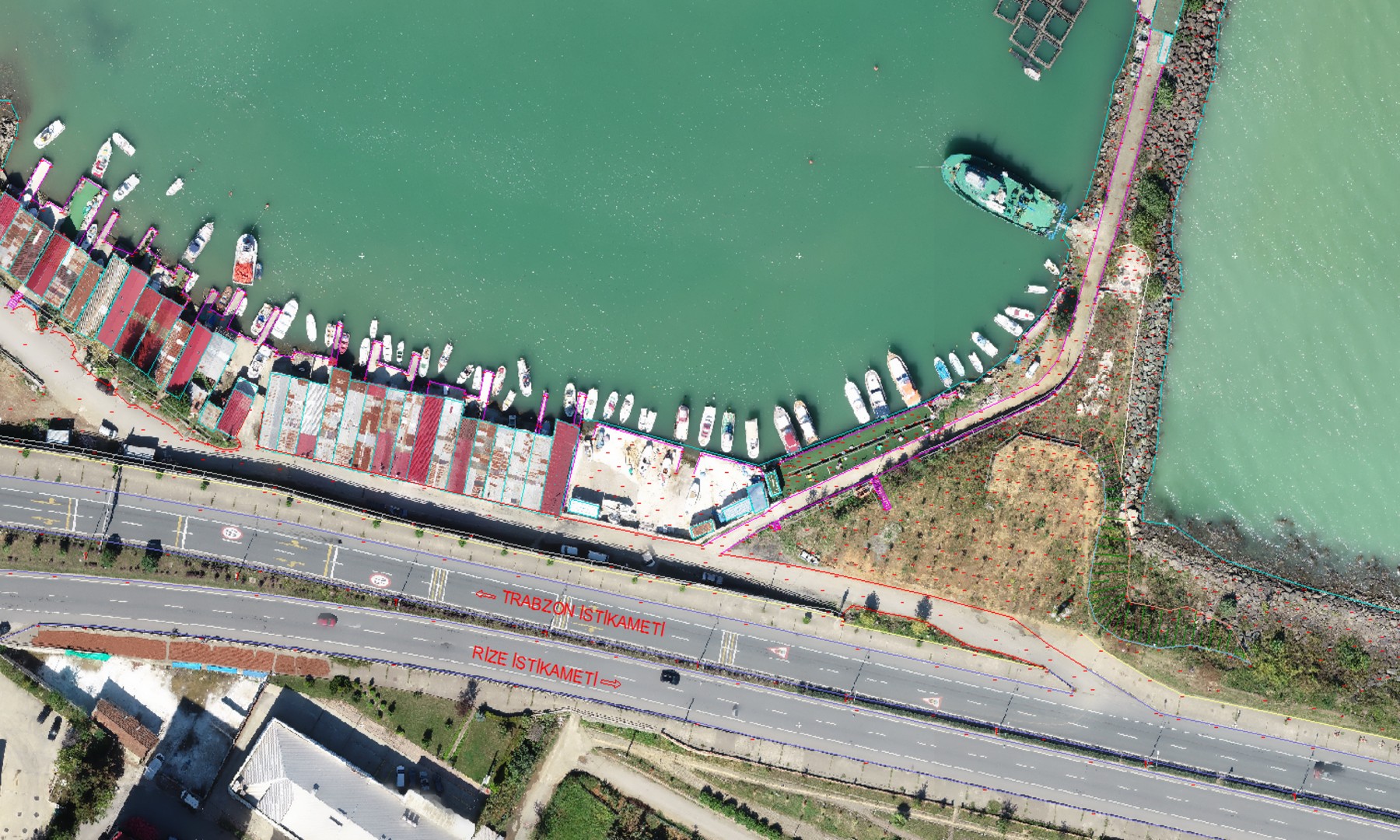
Digital photogrammetric current map production using UAVs for Yomra Fishermen’s Shelter coastal harbor project
Ministry of Transport and Infrastructure / Trabzon / 2020
Digital photogrammetric current map production using UAVs for Mamak Gendarmerie Security Command Complex, 45 ha
T.C. Ankara Governorship / Ankara / 2020
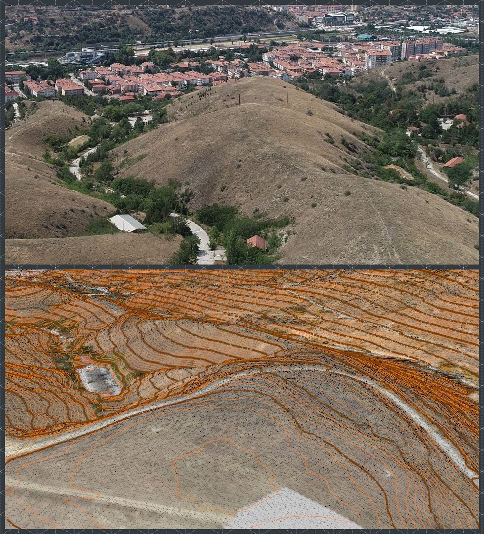
Digital terrestrial current map production and tree survey for Yamaçtepe Urban Design project site, 250 ha
Gaziantep Metropolitan Municipality / 2016
Authorship of Building Application Project, volume and excavation management project for Paloma Grida Belek Hotel
DIANA Hotel Investments Co. / Antalya / 2024

3. Ulaştırma Terminal Birlik Komutanlığı Kapak atma yeri ve Rıhtım onarımı projesi Batimetrik harita yapımı, 120 ha.
Millî Savunma Bakanlığı / Gazimağusa, KKTC / 2013